
Suhl
Schneekopf, 98528 Suhl, Deutschland
Schneekopf | Webcam & Hiking, Parking
The Schneekopf near Gehlberg in the independent city of Suhl is one of the most distinctive destinations in the Thuringian Forest. At 978 meters, it is the second highest elevation of the mountain range after the Großer Beerberg; the observation tower at the summit raises the viewpoint to 1,001.11 meters and makes the Schneekopf the only 1000-meter peak in Thuringia. The tourism pages of Oberhof and Gehlberg link the mountain with a webcam, hiking trails, a hut, parking lots, and proximity to the Rennsteig, making the visit well-planned for both summer and winter. Those who come here seek not only a view but also orientation: Where is the parking lot, how is the webcam, what does the weather show, where does the hiking trail lead, and how far is the Rennsteig? This page answers exactly those questions. ([oberhof.de](https://www.oberhof.de/en/poi/detail/schneekopf-4f9daa072e?utm_source=openai))
The place itself also fits the character of the mountain. Gehlberg is a state-recognized resort with a long tradition of tourism and hiking, surrounded by the highest mountains in Thuringia and directly near the Schneekopf. The region thrives on clear seasons, open summit views, quiet forest paths, and an offer that ranges from the Schneekopf webcam to the hiking park to winter trails, bus connections, and the New Gehlberg Hut. This makes the Schneekopf not just a peak but a complete nature and experience area in the heart of the Thuringian Forest. ([oberhof.de](https://www.oberhof.de/ort/gehlberg-6d87b2da93?utm_source=openai))
Schneekopf Webcam and Current Weather
The Schneekopf webcam is the first view of the mountain for many visitors. On the Panomax site, the Schneekopf is presented as a 360° HD camera at the highest viewpoint in the Thuringian Forest, and the official pages of Oberhof and Gehlberg also refer directly to the live image. This is practical because one can quickly check before departure whether the summit looks clear, misty, sunny, or foggy. This is particularly important at the Schneekopf, as weather and visibility can change noticeably in the higher elevations of the Thuringian Forest. Those planning a hike, a family outing, or a spontaneous photo stop get a realistic picture of the current situation at the mountain with the webcam. ([schneekopf.panomax.com](https://schneekopf.panomax.com/?utm_source=openai))
The webcam is not just a nice extra but a real planning tool. On the Panomax site, in addition to the live image, time-lapse and archive functions are shown, allowing weather moods, cloud movements, and visibility conditions to be traced throughout the day. This is particularly helpful for visitors with a longer journey, as one can estimate in advance whether the way to the tower, the hut, or the hiking trails is worth it. The Gehlberg page complements this with a direct weather reference, making the region very visitor-friendly: first look, then drive. This interplay of webcam, weather, and tour planning is one of the reasons why the Schneekopf is searched for online so often. ([schneekopf.panomax.com](https://schneekopf.panomax.com/?utm_source=openai))
Schneekopf Hiking, Rennsteig, and Hiking Park
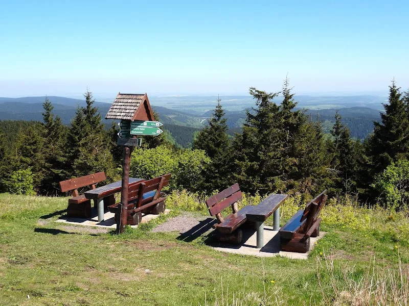
Around Gehlberg, hiking is not only possible but explicitly part of the experience. In the Gehlberg Hiking Park, signs inform about the special features of the areas, and the forest activity path to the Schneekopf leads from the Schneekopf parking lot about one kilometer to the plateau. This path has been a tourist offering since 2013 and is equipped with five stations about the animal and plant world. This is ideal for families or guests who want to experience the summit without a long tour: short access, clear path guidance, and learning and discovery stations along the way. For the ascent, the region still recommends sturdy footwear, as weather and ground conditions can change quickly in the low mountain range. ([gehlberg.net](https://www.gehlberg.net/index.php?id=346))
For those wanting more distance, there is a whole range of tours in the vicinity of the Schneekopf. The Erlebniswanderweg Gehlberg-Webersgeräum is about two kilometers long and focuses on experiencing nature with signs about minerals and natural history. The Alte Schmücker Weg leads about four kilometers from Gehlberg to the Schmücke, while the Wildererpfad, with about 9.2 kilometers, takes you to dark spruce forests, steep stairs, and wet meadows. Additionally, the Schneekopf is close to the Rennsteig; the Panomax site mentions the Rennsteig is only about 900 meters away. This makes the mountain interesting both as a short summit walk and as a component of longer tours. ([gehlberg.net](https://www.gehlberg.net/index.php?id=346))
Parking and Access to the Schneekopf
The parking situation at the Schneekopf is pleasantly transparent for a mountain of this popularity. The official Gehlberg page lists numerous public parking lots in and around the town, including the Kurpark parking lot, the bus turnaround parking lot with three hours of parking disc, the Am Ritter parking lot, the Schmücke parking lot, and the Schneekopf parking lot. Some areas in the town are free of charge, while other areas in the Rennsteig area are subject to fees; according to the page, the revenues serve to manage, clear, and maintain the forest parking lots as well as to prepare the winter and ski trails. This shows how closely nature experience and infrastructure are connected here. ([gehlberg.net](https://www.gehlberg.net/index.php?id=50))
For many visitors, the parking lot at the ski lift at the Ritter is also relevant, as there are free parking spaces available nearby according to Oberhof Tourism. Those arriving by bus and train also find good connections: Gehlberg lists bus connections from Suhl via Vesser, Schmiedefeld, Rennsteig intersection, Schmücke, and Gehlberg to Gräfenroda, as well as a second line via Schmalkalden, Steinbach-Hallenberg, Oberschönau, and Oberhof. This makes the Schneekopf accessible not only for drivers but also for guests without their own vehicle. The access is therefore not a secret but part of the clearly structured region around Oberhof and Gehlberg. ([oberhof.de](https://www.oberhof.de/attraktion/skilift-am-ritter-suhl-90f3a5901b?utm_source=openai))
Schneekopf Tower, Height, and View
The Schneekopf Tower is the central landmark of the summit and the reason why the mountain is considered a special viewpoint. According to the official Oberhof pages, visitors must overcome 126 steps to reach the platform. The tower height is given as 23.83 meters and the total height as 1,001.11 meters above NHN. This value makes the Schneekopf the only 1000-meter peak in Thuringia. Historically, the summit area has been interesting as a viewpoint since early on: a regional expert text mentions that an observation tower has been on the Schneekopf since 1852 and a new tower was inaugurated in 2008. The current tower is therefore not only modern but also ties into a long summit tradition. ([oberhof.de](https://www.oberhof.de/attraktion/aussichtsturm-auf-dem-schneekopf-11cadc3111?utm_source=openai))
The view also includes the New Gehlberg Hut. The Oberhof pages describe it as Thuringia's highest managed hut and hiking lodge at 964 meters above sea level. This is a real added value for hikers, as view, rest, and refreshment are closely linked here. The official Schneekopf entry describes the mountain as the second highest mountain in Thuringia with a grand view of the Thuringian Forest, and the combination of tower, hut, and open summit location makes the place attractive year-round. Therefore, those visiting the Schneekopf experience not only a short photo moment but a complete day of views with refreshments, wide vistas, and geographical uniqueness. ([oberhof.de](https://www.oberhof.de/en/poi/detail/schneekopf-4f9daa072e?utm_source=openai))
Schneekopf Run 2026 and Schneekopf Hiking
The Schneekopf is not only a destination for day-trippers but also a mountain for athletes. The official page of the Schneekopf Run states that July 4, 2026, is the event day; the route leads from Schmiedefeld over the Großer Finsterberg to the Schneekopf. The run is described as steep, demanding, and breathtaking, and the homepage highlights the distances of 12 and 22 kilometers. Additionally, since 2025, there is a Schneekopf hike for Nordic walkers and hikers. This makes the event significantly broader than just a classic mountain run and also appeals to active leisure hikers. ([schneekopflauf.de](https://schneekopflauf.de/))
The details on the official page are clear and helpful: The Schneekopf hike covers 11 kilometers and starts at the Rennsteig train station; the Schneekopf run offers a 12.7-kilometer variant as well as a 22.2-kilometer variant, both starting in Schmiedefeld. Pre-registration runs from December 1, 2025, to June 25, 2026, at 11:59 PM, followed by a late registration phase until June 30, 2026. Particularly exciting is the course of the run: it is explicitly marketed as a challenge with elevation gain, summit feeling, and goal boost on the Schneekopf. For the region, this is a strong event because it combines nature, endurance, and summit experience in one format. ([schneekopflauf.de](https://schneekopflauf.de/))
Schneekopf Balls and History of the Summit
The Schneekopf also has a geological history that goes far beyond the mere view. In a regional expert contribution, the summit is described as a porphyry mountain of the Rotliegend, and it is in this context that the so-called Schneekopf balls are known. These are volcanic porphyry ejecta, often containing crystal druses, usually in the form of agate. Popular scientific sources also emphasize that these spherical formations are geologically interesting and are referred to as Schneekopf balls or lithophytes. Therefore, those visiting the Schneekopf are not only standing on a viewpoint summit but also on a site with a visibly volcanic past. ([bsv-gotha.de](https://www.bsv-gotha.de/wp-content/uploads/2021/11/Ueber-allen-Gipfeln-ist-Ruh-Teil-2.pdf))
It is important to make a small but crucial clarification: The Schneekopf balls are named after the mountain but, according to several sources, do not necessarily occur on the actual summit peak but in the surrounding area of the Schneekopf and the Thuringian Forest. This makes the search for them so exciting but also so special. The Gehlberg pages support this understanding of nature with signs in the hiking park that point to nature and history, and the town itself tells a long settlement and usage history with its founding in 1645 by a glassworks. Thus, geology, culture, hiking, and regional identity combine at the Schneekopf to create a very distinctive experience area. ([schneekopfkugel.de](https://www.schneekopfkugel.de/?utm_source=openai))
The historical perspective also helps to better understand today's experiential value. Gehlberg is a state-recognized resort, surrounded by the highest mountains in Thuringia, and the Schneekopf has been the mountain where tourism, winter activities, and viewpoint themes have been concentrated for decades. The fact that the region today offers webcams, parking lots, hiking trails, bus lines, huts, and running events so naturally is the result of a long development. That is why the Schneekopf is not just a destination for a single summit view but a location where the past, present, and landscape overlap particularly impressively. ([oberhof.de](https://www.oberhof.de/ort/gehlberg-6d87b2da93?utm_source=openai))
Sources:
Show moreShow less
Schneekopf | Webcam & Hiking, Parking
The Schneekopf near Gehlberg in the independent city of Suhl is one of the most distinctive destinations in the Thuringian Forest. At 978 meters, it is the second highest elevation of the mountain range after the Großer Beerberg; the observation tower at the summit raises the viewpoint to 1,001.11 meters and makes the Schneekopf the only 1000-meter peak in Thuringia. The tourism pages of Oberhof and Gehlberg link the mountain with a webcam, hiking trails, a hut, parking lots, and proximity to the Rennsteig, making the visit well-planned for both summer and winter. Those who come here seek not only a view but also orientation: Where is the parking lot, how is the webcam, what does the weather show, where does the hiking trail lead, and how far is the Rennsteig? This page answers exactly those questions. ([oberhof.de](https://www.oberhof.de/en/poi/detail/schneekopf-4f9daa072e?utm_source=openai))
The place itself also fits the character of the mountain. Gehlberg is a state-recognized resort with a long tradition of tourism and hiking, surrounded by the highest mountains in Thuringia and directly near the Schneekopf. The region thrives on clear seasons, open summit views, quiet forest paths, and an offer that ranges from the Schneekopf webcam to the hiking park to winter trails, bus connections, and the New Gehlberg Hut. This makes the Schneekopf not just a peak but a complete nature and experience area in the heart of the Thuringian Forest. ([oberhof.de](https://www.oberhof.de/ort/gehlberg-6d87b2da93?utm_source=openai))
Schneekopf Webcam and Current Weather
The Schneekopf webcam is the first view of the mountain for many visitors. On the Panomax site, the Schneekopf is presented as a 360° HD camera at the highest viewpoint in the Thuringian Forest, and the official pages of Oberhof and Gehlberg also refer directly to the live image. This is practical because one can quickly check before departure whether the summit looks clear, misty, sunny, or foggy. This is particularly important at the Schneekopf, as weather and visibility can change noticeably in the higher elevations of the Thuringian Forest. Those planning a hike, a family outing, or a spontaneous photo stop get a realistic picture of the current situation at the mountain with the webcam. ([schneekopf.panomax.com](https://schneekopf.panomax.com/?utm_source=openai))
The webcam is not just a nice extra but a real planning tool. On the Panomax site, in addition to the live image, time-lapse and archive functions are shown, allowing weather moods, cloud movements, and visibility conditions to be traced throughout the day. This is particularly helpful for visitors with a longer journey, as one can estimate in advance whether the way to the tower, the hut, or the hiking trails is worth it. The Gehlberg page complements this with a direct weather reference, making the region very visitor-friendly: first look, then drive. This interplay of webcam, weather, and tour planning is one of the reasons why the Schneekopf is searched for online so often. ([schneekopf.panomax.com](https://schneekopf.panomax.com/?utm_source=openai))
Schneekopf Hiking, Rennsteig, and Hiking Park
Around Gehlberg, hiking is not only possible but explicitly part of the experience. In the Gehlberg Hiking Park, signs inform about the special features of the areas, and the forest activity path to the Schneekopf leads from the Schneekopf parking lot about one kilometer to the plateau. This path has been a tourist offering since 2013 and is equipped with five stations about the animal and plant world. This is ideal for families or guests who want to experience the summit without a long tour: short access, clear path guidance, and learning and discovery stations along the way. For the ascent, the region still recommends sturdy footwear, as weather and ground conditions can change quickly in the low mountain range. ([gehlberg.net](https://www.gehlberg.net/index.php?id=346))
For those wanting more distance, there is a whole range of tours in the vicinity of the Schneekopf. The Erlebniswanderweg Gehlberg-Webersgeräum is about two kilometers long and focuses on experiencing nature with signs about minerals and natural history. The Alte Schmücker Weg leads about four kilometers from Gehlberg to the Schmücke, while the Wildererpfad, with about 9.2 kilometers, takes you to dark spruce forests, steep stairs, and wet meadows. Additionally, the Schneekopf is close to the Rennsteig; the Panomax site mentions the Rennsteig is only about 900 meters away. This makes the mountain interesting both as a short summit walk and as a component of longer tours. ([gehlberg.net](https://www.gehlberg.net/index.php?id=346))
Parking and Access to the Schneekopf
The parking situation at the Schneekopf is pleasantly transparent for a mountain of this popularity. The official Gehlberg page lists numerous public parking lots in and around the town, including the Kurpark parking lot, the bus turnaround parking lot with three hours of parking disc, the Am Ritter parking lot, the Schmücke parking lot, and the Schneekopf parking lot. Some areas in the town are free of charge, while other areas in the Rennsteig area are subject to fees; according to the page, the revenues serve to manage, clear, and maintain the forest parking lots as well as to prepare the winter and ski trails. This shows how closely nature experience and infrastructure are connected here. ([gehlberg.net](https://www.gehlberg.net/index.php?id=50))
For many visitors, the parking lot at the ski lift at the Ritter is also relevant, as there are free parking spaces available nearby according to Oberhof Tourism. Those arriving by bus and train also find good connections: Gehlberg lists bus connections from Suhl via Vesser, Schmiedefeld, Rennsteig intersection, Schmücke, and Gehlberg to Gräfenroda, as well as a second line via Schmalkalden, Steinbach-Hallenberg, Oberschönau, and Oberhof. This makes the Schneekopf accessible not only for drivers but also for guests without their own vehicle. The access is therefore not a secret but part of the clearly structured region around Oberhof and Gehlberg. ([oberhof.de](https://www.oberhof.de/attraktion/skilift-am-ritter-suhl-90f3a5901b?utm_source=openai))
Schneekopf Tower, Height, and View
The Schneekopf Tower is the central landmark of the summit and the reason why the mountain is considered a special viewpoint. According to the official Oberhof pages, visitors must overcome 126 steps to reach the platform. The tower height is given as 23.83 meters and the total height as 1,001.11 meters above NHN. This value makes the Schneekopf the only 1000-meter peak in Thuringia. Historically, the summit area has been interesting as a viewpoint since early on: a regional expert text mentions that an observation tower has been on the Schneekopf since 1852 and a new tower was inaugurated in 2008. The current tower is therefore not only modern but also ties into a long summit tradition. ([oberhof.de](https://www.oberhof.de/attraktion/aussichtsturm-auf-dem-schneekopf-11cadc3111?utm_source=openai))
The view also includes the New Gehlberg Hut. The Oberhof pages describe it as Thuringia's highest managed hut and hiking lodge at 964 meters above sea level. This is a real added value for hikers, as view, rest, and refreshment are closely linked here. The official Schneekopf entry describes the mountain as the second highest mountain in Thuringia with a grand view of the Thuringian Forest, and the combination of tower, hut, and open summit location makes the place attractive year-round. Therefore, those visiting the Schneekopf experience not only a short photo moment but a complete day of views with refreshments, wide vistas, and geographical uniqueness. ([oberhof.de](https://www.oberhof.de/en/poi/detail/schneekopf-4f9daa072e?utm_source=openai))
Schneekopf Run 2026 and Schneekopf Hiking
The Schneekopf is not only a destination for day-trippers but also a mountain for athletes. The official page of the Schneekopf Run states that July 4, 2026, is the event day; the route leads from Schmiedefeld over the Großer Finsterberg to the Schneekopf. The run is described as steep, demanding, and breathtaking, and the homepage highlights the distances of 12 and 22 kilometers. Additionally, since 2025, there is a Schneekopf hike for Nordic walkers and hikers. This makes the event significantly broader than just a classic mountain run and also appeals to active leisure hikers. ([schneekopflauf.de](https://schneekopflauf.de/))
The details on the official page are clear and helpful: The Schneekopf hike covers 11 kilometers and starts at the Rennsteig train station; the Schneekopf run offers a 12.7-kilometer variant as well as a 22.2-kilometer variant, both starting in Schmiedefeld. Pre-registration runs from December 1, 2025, to June 25, 2026, at 11:59 PM, followed by a late registration phase until June 30, 2026. Particularly exciting is the course of the run: it is explicitly marketed as a challenge with elevation gain, summit feeling, and goal boost on the Schneekopf. For the region, this is a strong event because it combines nature, endurance, and summit experience in one format. ([schneekopflauf.de](https://schneekopflauf.de/))
Schneekopf Balls and History of the Summit
The Schneekopf also has a geological history that goes far beyond the mere view. In a regional expert contribution, the summit is described as a porphyry mountain of the Rotliegend, and it is in this context that the so-called Schneekopf balls are known. These are volcanic porphyry ejecta, often containing crystal druses, usually in the form of agate. Popular scientific sources also emphasize that these spherical formations are geologically interesting and are referred to as Schneekopf balls or lithophytes. Therefore, those visiting the Schneekopf are not only standing on a viewpoint summit but also on a site with a visibly volcanic past. ([bsv-gotha.de](https://www.bsv-gotha.de/wp-content/uploads/2021/11/Ueber-allen-Gipfeln-ist-Ruh-Teil-2.pdf))
It is important to make a small but crucial clarification: The Schneekopf balls are named after the mountain but, according to several sources, do not necessarily occur on the actual summit peak but in the surrounding area of the Schneekopf and the Thuringian Forest. This makes the search for them so exciting but also so special. The Gehlberg pages support this understanding of nature with signs in the hiking park that point to nature and history, and the town itself tells a long settlement and usage history with its founding in 1645 by a glassworks. Thus, geology, culture, hiking, and regional identity combine at the Schneekopf to create a very distinctive experience area. ([schneekopfkugel.de](https://www.schneekopfkugel.de/?utm_source=openai))
The historical perspective also helps to better understand today's experiential value. Gehlberg is a state-recognized resort, surrounded by the highest mountains in Thuringia, and the Schneekopf has been the mountain where tourism, winter activities, and viewpoint themes have been concentrated for decades. The fact that the region today offers webcams, parking lots, hiking trails, bus lines, huts, and running events so naturally is the result of a long development. That is why the Schneekopf is not just a destination for a single summit view but a location where the past, present, and landscape overlap particularly impressively. ([oberhof.de](https://www.oberhof.de/ort/gehlberg-6d87b2da93?utm_source=openai))
Sources:

Frequently Asked Questions
Reviews
No reviews found